
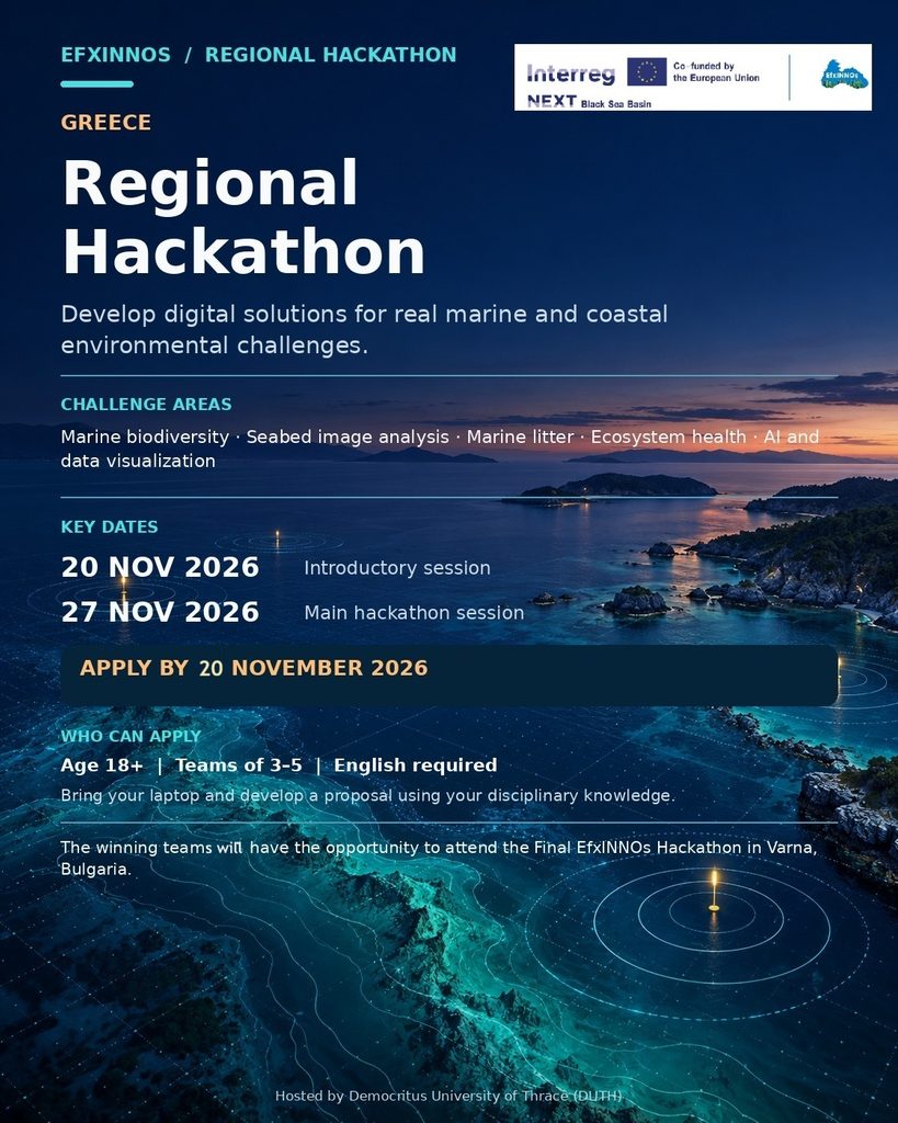
Applications must be submitted through the online form by 20 November 2026.
Application form: The form asks for full name, affiliation (professional, university/department/degree level, email address and mobile number.
The Regional Hackathon in Greece will bring together students, researchers, software developers, marine scientists, engineers, policy stakeholders, and young professionals to collaboratively develop innovative tools and applications based on the EfxINNOs project’s marine monitoring datasets and technologies. The event will focus on topics such as marine biodiversity mapping, automated seabed image analysis, marine litter detection, ecosystem health assessment, data visualization, and AI-driven environmental monitoring solutions. Participants will be encouraged to propose practical and scalable solutions addressing the environmental and socio-economic priorities of Greece and the wider Black Sea region, while exchanging knowledge and best practices with experts from across the project consortium.
The Greek Regional Hackathon will also serve as a preparatory platform for the Final EfxINNOs Hackathon, which will be hosted in Varna, Bulgaria. The event will support the development and refinement of innovative concepts and prototypes that may be further showcased during the Final Hackathon, where the most promising teams and solutions from all participating countries will come together. The Final Hackathon will provide a unique opportunity to strengthen cross-border collaboration, foster innovation, and promote advanced digital solutions that contribute to sustainable marine governance, ecosystem protection, and Blue Growth across the Black Sea Basin.
| Hackathon dates & Venue | 20 November, 2026 (introductory session), DUTH Campus, Xanthi (Room B5, PROKAT, DUTH campus) 27 November, 2026 (main hackathon session), Oikia Manou Chatzidaki (El. Venizelou 17, Xanthi) |
| Application deadline | 16 November 2026 |
Day 1: Friday 20 November 2026
| Time | Session | Presenter |
| 12:30-12:45 | Participants registration and introduction of the teams | |
| 12:45-13:00 | Opening and welcome remarks | Prof. Georgios Sylaios |
| 13:00-13:15 | EfxINNOs project and its results | Prof. Georgios Sylaios |
| 13:15-13:30 | EfxINNOs technology briefing (Introduction to microAUVs, ROVs, buoys, sensors, sonar, images, videos and AI/ML potential.) | Dr. Nikolaos Kokkos |
| 13:30-13:45 | Five sector lightning talks, Challenges and rules Introduction to jury members, mentors and judging criteria | Theofani Psomouli and Dr. Nikolaos Kokkos |
| 13:45-14:00 | Q/A |
Over the following week, participants will work (individually or in groups) to refine their ideas around the selected challenge.
During preparation week (21-26/11) participants can reach out for further assistance or guidance to Prof. Georgios Sylaios (gsylaios@env.duth.gr) or Dr. Nikolaos Kokkos (nikolaoskokkos@gmail.com)
Day 2: Friday 27 November 2026
| Time | Session | Presenter |
| 10:00-10:30 | Registration and Welcome Coffee | |
| 10:30-12:30 | Team Presentations & Q&A | Each team presents its solution to the jury, followed by questions and discussion. |
| 12:30-13:00 | Coffee Break | |
| 13:00-14:00 | Jury Deliberation and Evaluation | Jury Members |
| 14:00-14:30 | Awards Ceremony | Announcement of the winning teams and presentation of certificates and awards. |
| 14:30-15:00 | Closing remarks Group Photo | Closing remarks, information on the next steps towards the Final EfxINNOs Hackathon in Varna, Bulgaria. |
| 15:00-16:00 | Lunch | |
Five Sector Challenge Briefs
1 Ports and maritime logistics
Ports concentrate vessel traffic, cargo operations, dredging, wastewater risk, accidental spills, underwater noise and sediment disturbance. They are also essential economic infrastructures. A monitoring system for ports should help operators and authorities detect environmental pressure early, document improvements and plan greener operations.
| Priority parameters | The most relevant parameters are turbidity, dissolved oxygen, hydrocarbons, pH, salinity, currents, underwater noise, sediment quality, marine litter, AIS-based vessel intensity and seabed habitat condition near port areas. |
| Monitoring architecture | A credible port concept may combine fixed buoys in port approaches or harbour basins, periodic microAUV/ROV seabed surveys, satellite or UAV context for plumes and surface patterns, AIS pressure layers and a dashboard for port authorities and environmental agencies. |
| Decision outputs | The decision outputs may include dredging windows, spill-risk alerts, basin flushing interpretation, marine litter hotspot maps, underwater noise risk maps and environmental performance reports. |
2 Shipyards and marine engineering
Shipyards and repair areas may create risks linked to antifouling paints, metals, suspended solids, cleaning operations, maintenance residues and waste leakage. At the same time, shipyards need practical tools that support compliance and cleaner operations without disrupting core activities unnecessarily.
| Priority parameters | Relevant parameters include turbidity, sediment contamination, heavy metals, hydrocarbons, pH, marine litter, paint-related residues, seabed visual condition and local hydrodynamics. |
| Monitoring architecture | A shipyard concept should be careful about measurement feasibility. A buoy or spot sensor can follow turbidity and basic water quality, but contaminants such as metals and many organic pollutants require sediment and water sampling with laboratory analysis. ROV imagery can inspect outfalls, seabed debris and maintenance zones. |
| Decision outputs | Decision outputs may include risk zoning, inspection priorities, sampling schedules, waste-leakage checks, sediment management recommendations and cleaner maintenance practice guidance. |
3 Coastal and marine tourism
Tourism depends on clean water, attractive beaches, healthy marine life, safe recreation and public trust. Tourism can also create pressure through litter, anchoring, diving, boating, coastal construction and seasonal wastewater loads. A tourism monitoring system should protect both ecosystem quality and destination reputation.
| Priority parameters | Relevant parameters include water temperature, turbidity, chlorophyll-a, dissolved oxygen, litter, bathing water indicators where data are available, seagrass cover, mooring damage, underwater visibility, visitor intensity and coastal safety signals. |
| Monitoring architecture | A tourism concept may use buoys for water-quality trends, UAV or beach surveys for shoreline litter, ROV imagery for attractive underwater communication and habitat checks, citizen reporting for litter or unusual water colour, and satellite data for wider bloom or plume context. |
| Decision outputs | Decision outputs may include responsible tourism maps, beach and dive-site information, litter cleanup priorities, anchoring guidance, public alerts and municipality-friendly dashboards. |
4 Fisheries
Fisheries need productive habitats, fair access to resources and trust in management. Monitoring can support fishers by protecting nursery habitats, identifying ghost gear, documenting benthic impacts and reducing conflict between fishing and other maritime uses.
| Priority parameters | Relevant parameters include seabed habitat type, seagrass cover, trawling marks, ghost gear, marine litter, dissolved oxygen, temperature, chlorophyll-a, fisheries effort data, nursery habitat indicators and currents that influence larvae or litter transport. |
| Monitoring architecture | A fisheries concept may combine microAUV or ROV seabed mapping, side-scan sonar for large objects and trawling marks, fishers’ observations through a moderated reporting tool, AIS or effort data where appropriate, and GIS layers identifying sensitive habitats and conflict zones. |
| Decision outputs | Decision outputs may include habitat protection maps, ghost gear removal priorities, seasonal risk advisories, gear-conflict maps, evidence for co-management and recommendations for sustainable fishing zones. |
5 Aquaculture
Aquaculture sustainability depends on water quality, oxygen availability, suitable currents, disease and bloom risk, feed management and benthic footprint. Monitoring should help operators adapt practices early while giving authorities and communities confidence that farms are managed responsibly.
| Priority parameters | Relevant parameters include temperature, salinity, dissolved oxygen, turbidity, chlorophyll-a, nutrients, currents, sediment organic enrichment, benthic visual condition and harmful algal bloom risk proxies. |
| Monitoring architecture | An aquaculture concept may combine a buoy with oxygen, temperature, salinity, turbidity and chlorophyll-a sensors; ROV inspections of the seabed footprint; current measurements for dispersion; satellite context for bloom signals; and laboratory sampling for nutrients or sediment quality. |
| Decision outputs | Decision outputs may include oxygen alerts, feeding recommendations, fallowing or rotation support, bloom risk communication, site suitability maps and transparent sustainability reporting. |
Join the EfxINNOs Regional Hackathon to collaborate with students, researchers, technology specialists and industry representatives in developing innovative solutions for real challenges facing the marine and coastal environment. Participants will gain practical experience, receive guidance from mentors, expand their professional network and present their ideas to an expert jury. All participants will receive certificates, while the winning team may have the opportunity to travel to Varna, Bulgaria, and participate in the Final EfxINNOs Hackathon.
- Individuals or groups that will form teams of 3-5 people
- Age limit: >18
- Good knowledge of English is mandatory
Participants must bring their own laptops. Each application must present an individual proposal focused on one of the five sectors, drawing on the applicant’s disciplinary knowledge and methods.
- The winning team will have a chance to travel to Varna, Bulgaria, and participate in the EfxINNOs Final Hackathon.
- Certificates will be provided
Final hackathon in Bulgaria: travel and accommodation costs for up to eight (8) participants will be covered by the project budget.
Individual applications: a 100-point assessment
The blind assessment of individual applications will use the eight criteria below, with a maximum total score of 100. Selection of participants per sector will be based on this assessment.
| Criterion | Points | Description |
|---|---|---|
| Integration across five sectors | 15 | The solution genuinely serves ports, shipyards, tourism, fisheries and aquaculture rather than mentioning them superficially. |
| Technical monitoring logic | 20 | The team selects appropriate parameters, platforms and sensors and recognises limitations. |
| Data-to-decision strength | 15 | Raw data becomes indicators, maps, alerts, dashboards or recommendations in a coherent pathway. |
| Environmental and Blue Growth impact | 20 | The system can reduce marine pressure while supporting sustainable economic activity. |
| Feasibility and pilot realism | 15 | The concept can be piloted with realistic equipment, permissions, data validation and stakeholder roles. |
| Stakeholder usability | 10 | Real users would understand, trust and use the outputs. |
| Pitch and teamwork | 5 | The team communicates clearly and shows collaborative ownership. |
Total: 100 points.
Final team presentations
At the end of the Greek Regional Hackathon, each team will present its solutions to a jury of sector stakeholders.
